

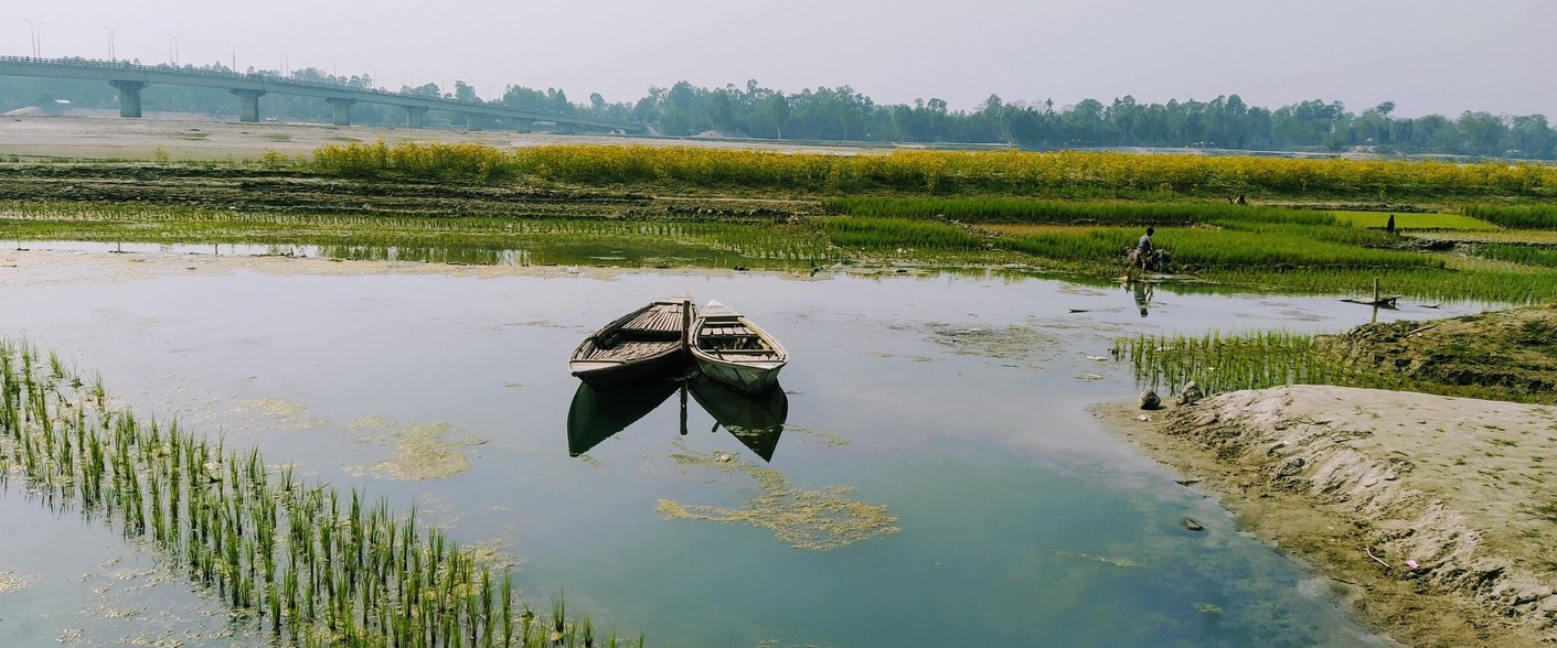

Bangladesh is celebrated as a riverine country. The Ganges-Padma, Brahmaputra-Jamuna, and Meghna are the three major river systems that dominate the hydrology and geography of Bangladesh. They are more than waterways – they are highways of history, carriers of culture, and witnesses to the daily rhythms of life. It is a great delta formed by the three mighty Himalayan Rivers. The country is home to one of the world’s longest natural water systems, stretching over 24,000 kilometres of rivers, canals and water bodies. Surprisingly, Bangladesh does not have any appropriate definition of these water bodies. Around 90 percent of water in those transboundary rivers comes from outside our borders, so we have limited control. Bangladesh faces floods during the wet season and water scarcity during the dry season. During the dry season, feeder channels dry up, and pollution worsens the situation.
Officially prepared lists of rivers in Bangladesh have changed year after year. Many of us who have worked on river issues for a long time believe that Bangladesh has more than two thousand rivers. Another report lists 1,415 rivers in government records, yet a recent study paints a bleak picture. Other reports said that the number of rivers is around 1,100. The Bangladesh Water Development Board, in a publication in 2011, said that there are 405 rivers in the country. A 2025 study by the River and Delta Research Centre (RDRC) reveals a grim reality. At least 79 rivers across the country have either died or are drying up. However, many of them are already on the verge of partial disappearance. One of the main reasons for confusion over the number of rivers in Bangladesh is that there is no authoritative organisation to ascertain the number.
Rivers in Bangladesh are dying for three main reasons: upstream dams on transboundary rivers, harmful infrastructure, and pollution from encroachment. Experts also say that rivers die in three ways – physically, biologically, and chemically. The nation needs to take better care by reducing pollution, preventing erosion, and restoring ecosystems. But Bangladesh cannot solve this problem alone. Since these rivers flow through multiple countries, cooperation with upstream neighbours is essential. Despite frequent discussions about protecting rivers, which are vital for livelihoods, transport, agriculture, and ecological balance, there has been little effective government action to save them.
One cannot finalise the number of rivers before adopting a proper definition of river. A study of the CS (Cadastral Survey) and RS (Revisional Survey) documents of the survey department can reveal the actual number of rivers in the country. In 2009, the High Court granted rivers the legal status of living entities. But almost all the country’s rivers are struggling to survive under the weight of encroachment, pollution and sand-lifting. The National River Conservation Commission Act, 2013, made the National River Conservation guardian of the river. It describes a relationship where an individual or organisation assumes the day-to-day responsibilities, care, and financial obligations of a parent without formal legal adoption or court-appointed guardianship. The Commission should perform many functions, including making recommendations to the government to free the rivers from illegal occupation and to prevent reoccupation and to make recommendations to keep the water of rivers free from pollution. Unfortunately, the river has not been defined in this law or any other law in Bangladesh.

A river flows from its source on high ground, across land, and then into another body of water. This could be a lake, the sea, an ocean or even another river. It is a natural stream of fresh water that flows into an ocean or other large body of water and is usually fed by smaller streams, called tributaries, that enter it along its course. A river and its tributaries form a drainage basin, or watershed, that collects the runoff throughout the region and channels it along with erosional sediments toward the river. The sediments are typically deposited most heavily along the river’s lower course, forming floodplains along its banks and a delta at its mouth.
Bangladesh authorities use an operational definition of river. A river is generally a natural watercourse that runs perennially or seasonally from definite sources (e.g. hills, rivers, waterbodies), with defined banks, contributes to the water and sediment budget of the basin/catchment, and discharges into an outfall such as rivers, waterbodies, Bay of Bengal. A socially and historically recognised watercourse will also be considered as a river. The nature of a river is that it is a flow along a channel with banks on both sides and a bed at the bottom. In Bangladesh, a river is understood to be any natural watercourse originating from glaciers, lakes, springs, or other water bodies that flows perennially or seasonally between defined banks.




There is no complete definition of river in any law of the country. The Inland Water Transport Authority Rules, 1959 defined inland water as any canal, river, lake or any other navigable Water in Bangladesh.
The rivers are demarcated in the Cadastral Survey (CS) of 1913 and the Revised Survey (RS) of 1983. A HC judgment had observed that primarily a river consists of a bed, foreshores, and banks. So, it should be demarcated accordingly as defined in the Port Rules 1966. The court ordered the Deputy Commissioners of some Districts around Dhaka City to retain the eroded areas and form land [shoals] as part of these rivers, set up boundary pillars, build walkways and plant trees on the banks. Boundary pillars are to be erected again as per the CS and RS.
The Port Rules, 1966 defined ‘bed of a navigable waterway’ as that portion of the soil and subsoil which is habitually covered by the waters of a navigable waterway and extends to the high water-mark on both banks of a navigable waterway. It includes any area defined hereinafter as foreshore. Foreshore means that subsoil which lies between the high-water-mark and low-water-mark. High-water-mark means a line drawn through the highest points reached by ordinary spring tides at any season of the year. Low-water-mark means a line drawn through the lowest points reached by ordinary spring tides at any season of the year. Bank means land which confines the waters of a water-way in its channel or bed in its whole width and extends above high-water-mark.
It has been reported that the proposed National River Conservation Commission (Amendment) Act will include a definition of a river. Experts and all concerned organisations have agreed that there should be a clear definition for the river considering the existing rules and verdict of the High Court Division of the Bangladesh Supreme Court.
The views expressed in this article are solely those of the author
The writer is a CEO, Bangla Chemical & Legal Economist. E-mail: [email protected]