

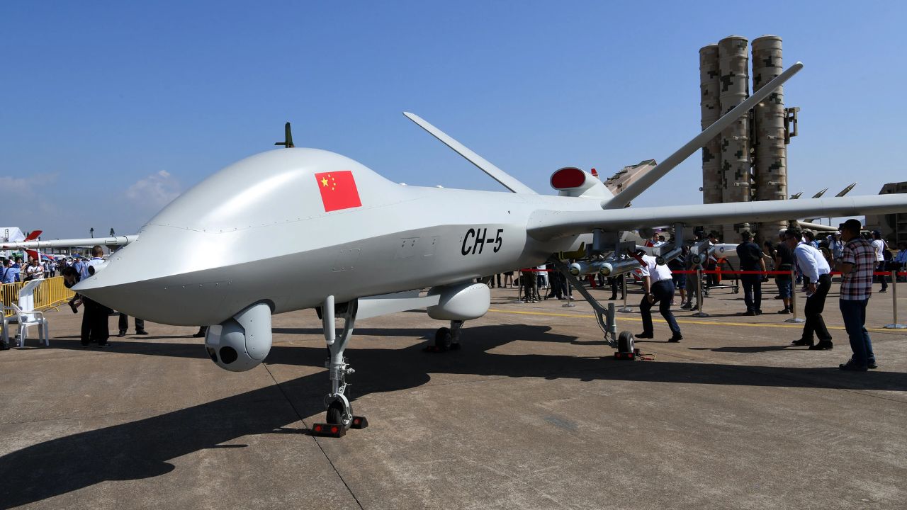



A large Chinese military drone has carried out repeated flights over the South China Sea in recent months while broadcasting false transponder signals that made it appear to be other aircraft, including a sanctioned Belarusian cargo plane and a British Typhoon fighter jet, according to flight data reviewed by Reuters.
Security analysts and diplomats monitoring the activity say the operations mark a significant evolution in China’s “grey-zone” tactics and could represent testing of decoy capabilities in preparation for a potential conflict over Taiwan.
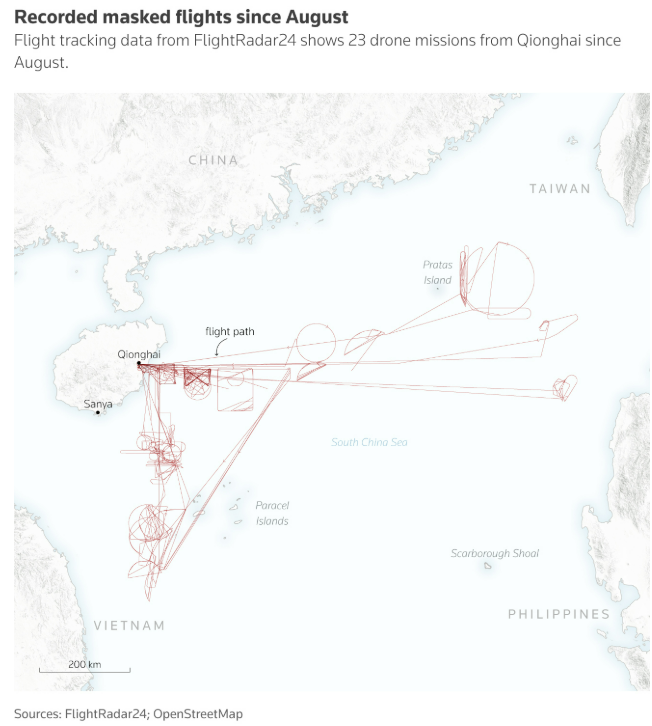
Since August, at least 23 sorties have been recorded under the call sign YILO4200, identified by open-source intelligence analysts as a long-endurance Wing Loong 2 unmanned aerial vehicle. However, during those flights the aircraft transmitted registration numbers belonging to other planes, according to analysis of data from flight-tracking website Flightradar24.
The routes frequently ran east from Hainan province towards the Philippines, near the disputed Paracel Islands, and south along Vietnam’s coastline. Reuters is reporting the scale and complexity of the operations for the first time.
Three regional diplomats, four open-source analysts and three security scholars familiar with the data said the flights reflect Beijing’s push to enhance military readiness and experiment with electronic warfare and deception in real time. Although such masking would be unlikely to fool military-grade radar or air traffic control systems, they said it could create confusion in a fast-moving conflict, obscure surveillance missions or serve propaganda purposes.

“We’ve not seen anything like this before,” said Ben Lewis, founder of the open-source platform PLATracker. “It’s a kind of deception trial being carried out in real time using aircraft that are not exactly low profile. It does not appear to be at all accidental.”
China’s defence ministry did not respond to questions from Reuters about the flights.
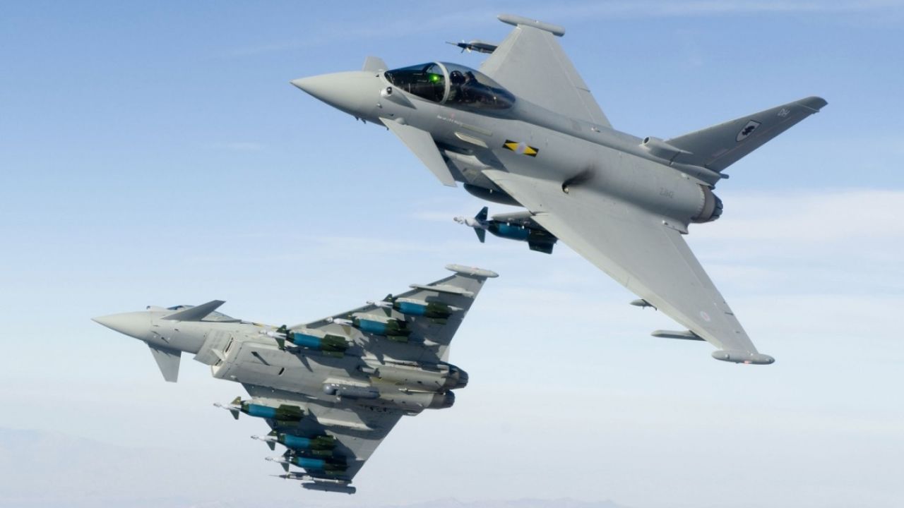
Most of the sorties appeared on Flightradar24 as an Ilyushin-62 cargo aircraft operated by Belarus-based Rada Airlines. At other times, the drone’s transponder signalled that it was a Royal Air Force Typhoon, a North Korean Il-62 passenger jet or a Gulfstream executive aircraft.




Aircraft registration codes derive from a unique 24-bit address overseen by the International Civil Aviation Organization (ICAO). The codes, transmitted via onboard transponders, allow tracking of an aircraft’s position, speed and direction. Two pilots and two analysts said the codes are publicly known and can be altered.
Rada Airlines was sanctioned by the U.S. Office of Foreign Assets Control in August 2024 for transporting cargo in Africa, including personnel linked to the Russian Wagner Group and exotic wildlife. Flightradar24 data showed the genuine Rada Il-62 remained active under a separate call sign during the same period and was airborne at least once simultaneously with the Chinese drone that appeared to be imitating it.
Rada Airlines did not respond to a request for comment. Britain’s defence ministry said it could not comment. An ICAO spokesperson declined to comment on specific member states.
Operating from Qionghai Boao International Airport in Hainan, a dual-use civilian and military facility, the aircraft often remained airborne for hours, tracing star- and hourglass-shaped patterns consistent with surveillance missions. Four analysts said the areas covered include sensitive waters frequented by submarines.
Chinese military drones typically operate “dark”, without transmitting identifying signals. In one flight spanning Aug 5–6, the aircraft initially broadcast a code linked to an RAF Typhoon before switching between three other identities over about 20 minutes, landing as the Rada Airlines plane. On Nov 18, it appeared as the Belarusian aircraft while the real Il-62 departed near Belarus bound for Tehran.
Satellite images from July, September and January reviewed by Reuters show large drones on the tarmac at Boao alongside support infrastructure.
Singapore-based analyst Alexander Neill said the operations appear designed to “muddy the waters” if tensions escalate. “Anything the Chinese can do to sow confusion in the minds of their rivals is to their advantage,” said Neill, a fellow at Hawaii’s Pacific Forum.
The flight paths pass through heavily trafficked naval corridors, including waters near Chinese submarine bases south of Hainan and towards the Bashi Channel between Taiwan and the Philippines, a key gateway to the Pacific.
When mapped over Taiwan, the routes intersect multiple military sites, particularly around Taipei and along the southern coast, and extend towards US and Japanese bases in Okinawa and the Ryukyu Islands.
“It is a compelling image – extensive rehearsals across the South China Sea to be deployed over Taiwan’s key points,” Neill said.