



The Buriganga has long been part of Dhaka’s identity, connecting the city to its people, trade and transportation. Along its banks, however, the river is increasingly surrounded by activities that blur the line between the waterway and the city.
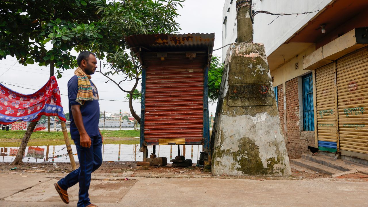
Concrete boundary pillars stand at different points along the river, marking its legal limits. Yet around many of them, everyday economic life continues: Sand is stored, shops operate, workers gather, and businesses occupy the surrounding space.
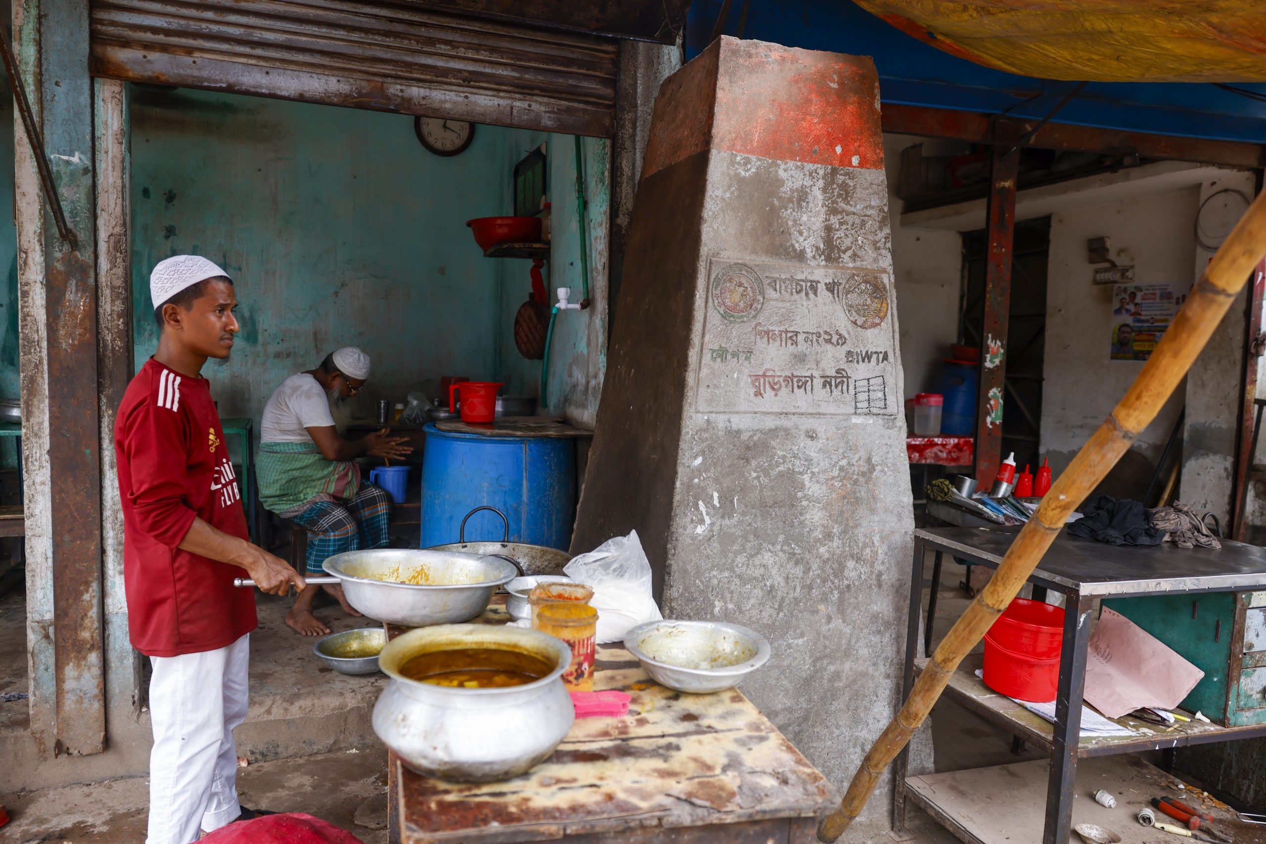
In some places, the pillars have become almost indistinguishable from the landscape they were intended to define.

For the people working along the Buriganga, these spaces are places of livelihood. For the river, they represent a gradual loss of its edge. The transformation is rarely sudden. It happens piece by piece, as commercial activity grows around the river and the boundary between public waterway and occupied land becomes harder to see.



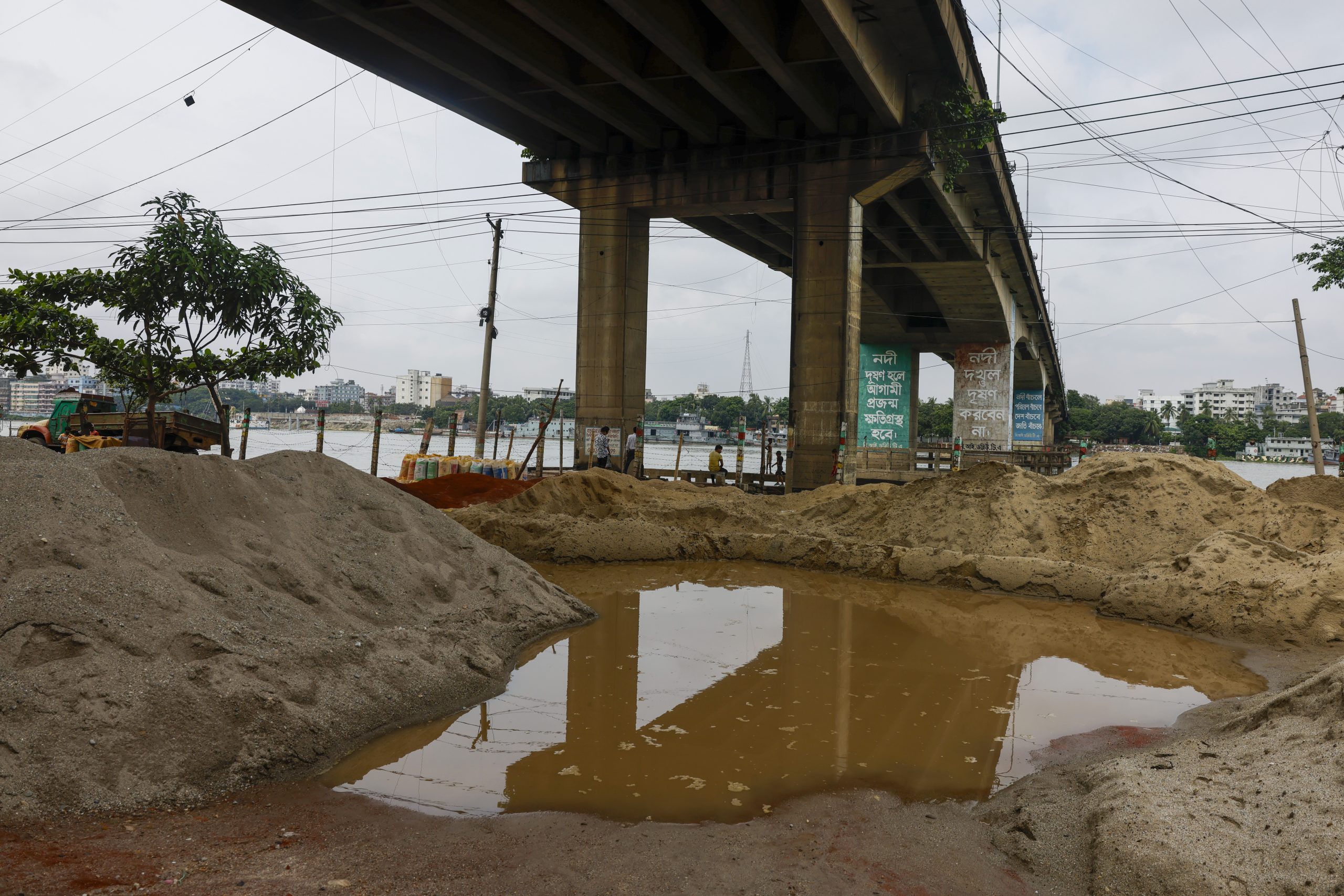
The pillars remain as quiet markers of that boundary. But around them, the city continues to move closer to the river. Each day, sand is piled higher, shops extend further, and the river’s edge recedes a little more.
These photographs document that changing relationship between the Buriganga and the people who live and work along its edge.
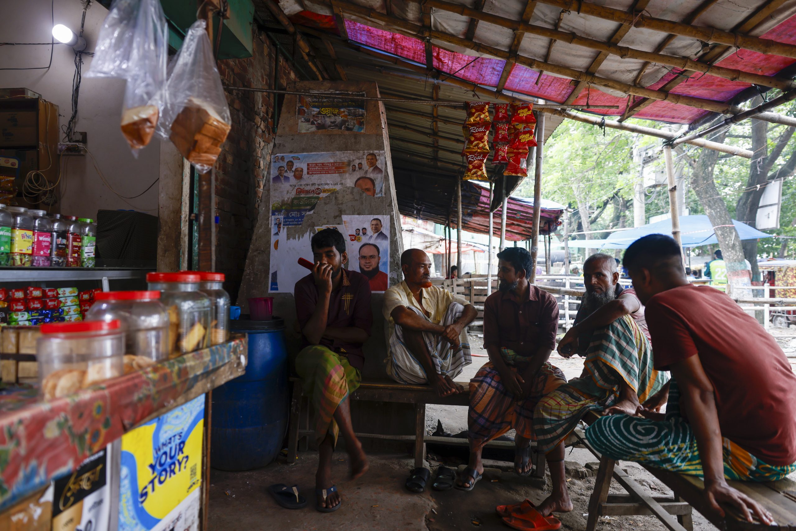
What they capture is not just a physical encroachment, but a slow erasure of the boundary that once defined the river as a separate entity. The Buriganga, once the lifeblood of Dhaka, is now being absorbed by the city it helped build.
The concrete pillars stand as the river’s last line. But as the city continues to press closer, one wonders how long even that line will remain visible.