





Chattogram is being systematically dismantled led by the very institutions sworn to protect it. The city’s hills, once its defining geographical signature, are vanishing, not merely through illegal encroachment, but via state-sanctioned progress.
As roads widen, hospitals expand, and housing complexes rise, each “milestone” is measured in the tragic volume of excavated earth.
This is development by subtraction, an equation where the arithmetic no longer adds up.
While the skyline grows, the environmental foundation crumbles. Hilly terrain that once spanned 25 per cent of the city has been cannibalised down to a mere 10 per cent.
This staggering loss leaves experts and residents haunted by a single, grim question: Is Chattogram’s “progress” simply the act of digging its own grave?
A vanishing landscape
British-era Royal Survey records, better known as RS Survey, reveal a lost world: more than 200 hills once defined the Chattogram skyline. By 2025, that number had plummeted to just 73.
This catastrophic decline recently forced the District Administration to form five special committees in a desperate bid to save the city’s remaining topography.
Sakhawat Jamil Saikat, the Additional Deputy Commissioner (Revenue), warns that these surviving peaks are under such constant siege they require literal guards to survive. “Influential individuals and institutions are relentlessly attempting to carve out pieces of these hills,” he noted.
Even Parir Pahar, the symbolic seat of the Divisional Commissioner, is not immune with hosting over 100 illegal structures currently.
The city’s history is already written in mud and blood. On June 11, 2007, torrential rains triggered a series of landslides that buried 127 people alive in a single day.
In the two decades since, nearly 300 lives have been lost to similar disasters.
While that 2007 tragedy birthed the Hill Management Committee, the “arithmetic of subtraction” remains unchanged: nineteen years later, the pattern of destruction persists.

Life on the edge: The human shield
The crisis is most visible in the “hanging” settlements of Lalkhan Bazar and Motijharna, where gravity seems to be the only regulation still enforced.
Here, thousands live in the shadow of catastrophe.
Yousuf, a local van driver, lives in a shack leaning against a vertically sliced hill.
To a geologist, this wall of red clay is a “90-degree death trap”; to Yousuf, it is simply home. “Every monsoon, we lose our sleep,” he says, his eyes tracking the fresh cracks in the earth above his roof. “We know the mountain can swallow us, but the city’s rent would starve us first. We are caught between a landslide and a hunger strike.”
His neighbour, Mariam Begum, echoes this grim calculation. She gestures toward the “loudspeaker warnings” issued by the district administration every June.
“They tell us to leave because it is dangerous. But where?” she asks. “If there were a safe place for the poor, we wouldn’t be clinging to this mud.”
The irony of state-led destruction
Perhaps the most damning aspect of Chattogram’s vanishing topography is that the primary aggressors are not just private land grabbers, but the state’s own development agencies.
The Chattogram Development Authority (CDA), the body mandated to plan the city, stands as a lead violator. For the Bayezid–Faujdarhat Link Road project, the CDA was slapped with a record Tk 10.38 crore fine in 2020. They had excavated 1.028 million cubic feet of hill material, far exceeding their permit.



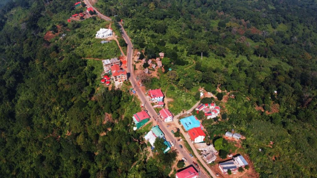
More lethally, they ignored the mandatory 45-degree safety slope rule, leaving behind sheer 90-degree vertical cliffs.
On Chatteswari Road, the pattern repeats. To make way for the China-funded Burn Unit of Chattogram Medical College Hospital, vast hilly interiors have been leveled.
While the Department of Environment (DoE) claims the approval for this excavation is still pending “inter-ministerial resolution,” the reality on the ground is different: a massive portion of the hill was razed before a single signature was secured.
Nearby, the expansion of student hostels for the same medical college has left the roadside hills flattened, creating a massive landslide risk for the upcoming monsoon.
The destruction also extends beyond the city limits; the Roads and Highways Department (RHD) was recently fined Tk 9 lakh for illegal cutting during the Baraiyarhat-Heako road expansion.
Despite the penalties, the agencies remain defiant.
Zahid Hossain, an RHD Superintending Engineer, argued that hill cutting is an “unavoidable necessity” for regional connectivity. “In Chattogram, there is no alternative,” he asserted.
“The irony is painful,” says Aliur Rahman of the Bangladesh Environmental Lawyers Association (BELA). “We build a burn unit to save lives, but we destroy the hills in a way that risks hundreds of others through landslides.”
The legal framework versus the excavator
The Bangladesh Environment Conservation Act is unequivocal: unauthorised hill cutting is a crime. Technical guidelines are equally precise, mandating a 30 to 45-degree slope to ensure geological stability.
Yet, a walk through AK Khan or Firoz Shah areas reveals a different reality: sheer “walls” of red earth standing at impossible angles, held back by nothing but hope.
Department of Environment (DoE) records show that 112 cases have been filed for hill destruction since 2003.
However, a telling pattern emerges – almost all these legal actions target private individuals or minor firms, rarely touching the state agencies leading the largest excavations.
The DoE itself admits the limits of its reach. Director Begum Sonia Sultana noted that while large-scale institutional projects are sometimes halted, the slow, individual-level erosion of the landscape continues unabated.
Her assessment of the damage is as grim as it is final: “We can issue fines and hold hearings, but a hill, once cut, can never be restored,” she said. “You cannot glue a mountain back together.”
The misclassification loophole
A critical catalyst for the ongoing destruction is the systematic misclassification of hills in official land records.
Across Chattogram and its neighbouring upazilas, at least 150 hills, spanning roughly 1,400 acres, have been erroneously recorded as ‘nal’ (low-lying farmland), ‘shankhola’ (grassland), ‘khila’ (fallow land), or ‘bari’ (homestead).
This clerical “error” creates a massive legal hurdle.
“Even when we file cases, the courts often prioritise the official land record over the physical reality on the ground,” explains Sonia Sultana, Director of the DoE’s Chattogram Metropolitan Office.
State Prosecutor Humayun Kabir Talukder, who represents the DoE in environmental court, echoes this frustration. “If a site is legally recorded as a hill, executive officers can intervene immediately. But when it is labeled as a homestead or farmland, the burden of proof becomes nearly impossible. Offenders walk free simply because the records are wrong.”
The case of “Grindlays Bank Hill” in Askardighir Par is a prime example.
Despite its 127-foot height, the site was classified as bari in the Bangladesh Survey (BS Survey).
Exploiting this, the CDA approved a multi-story building in 2022. Though the permit included 87 conditions, including a strict ban on hill cutting, much of the land has since been excavated. Today, a six-story structure stands on the site, rising even as government raids repeatedly confirm the illegal activity.
Enforcement in motion
Recent months have seen a flurry of enforcement activity. In April 2025, the CDA launched a demolition operation against a high-rise project at Askar Dighi Par, citing rampant environmental violations. The developer had allegedly ignored a 60 percent open-space requirement and excavated the hilltop despite explicit prohibitions.
More recently, in February 2026, the Department of Environment (DoE) fined the Bangladesh Petroleum Corporation (BPC) Tk 9.6 lakh for illegally cutting into a hill in the Jamalkhan area to build a rest house. Investigators found that approximately 9,600 cubic feet of soil had already been removed.
While these actions signal a tightening of the leash, they remain fundamentally reactive. In a city where population density and land prices continue to soar, the excavator almost always moves faster than the law.
A city at the crossroads
Chattogram stands at a critical juncture. On one side is the relentless drive for modernization – wider roads, sprawling hospitals, and vertical housing.
On the other is the fragile ecological identity of a city that cannot survive without its natural drainage systems and mountain windbreaks.
Professor Alok Paul of the Department of Geography and Environmental Studies at Chattogram University, warns that these hills are the city’s life-support system. “They are not merely dirt and stone; they are anchors for biodiversity and human livelihoods,” he explains.
“Hill cutting disrupts the food chain and strips away green cover, while the resulting silt clogs our canals. We are trading our natural cooling systems for rising temperatures and urban crises,” added.
Beyond the surface, researchers note that hills act as tectonic anchors, mitigating seismic risks. Their disappearance does not just invite landslides; it destabilises the very ground beneath the city.
If this rate of destruction continues, Chattogram will be reduced to a flat, concrete expanse, one that drowns in every rain and crumbles in every storm.
For those living on the precarious slopes, the coming monsoon is no longer a season; it is a countdown.