The United Nations General Assembly has backed a push to promote a world map that gives a more proportionate representation of the size of continents, in a move that has triggered territorial concerns from India, Ukraine and Japan.
The resolution, passed overwhelmingly last week, encourages countries to use the Equal Earth projection, which offers a more accurate comparison of landmass sizes than the widely used Mercator projection, reports Al Jazeera.
The initiative came after months of campaigning by the African Union, which adopted the Equal Earth map in February. Of the countries that voted, 164 supported the resolution, while six abstained.
The United States was the sole country to vote against it. Speaking before the vote, US representative Yaryna Ferencevych criticised the initiative, saying the resolution was “the reason this institution is losing its credibility”.
“Instead of focusing on genuine problems … this body is debating map projects from the 16th century,” she said.
The resolution does not require countries to abandon the Mercator projection or make Equal Earth compulsory. Instead, it calls on them to consider adopting the newer projection, developed by three researchers in 2018.
The objections from India, Ukraine and Japan are also not directed at the concept of replacing Mercator. Their concerns centre on how the new map represents territories whose ownership or status is disputed.
Why change the world map?
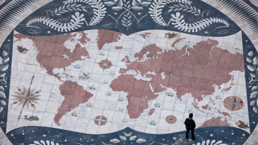
The Mercator projection was developed by Flemish cartographer Gerardus Mercator in 1569. Designed to represent the spherical Earth on a flat surface, it distorts the relative size of land areas, particularly towards the poles.
As a result, countries and regions in northern and southern latitudes appear considerably larger than they actually are, while areas closer to the equator are comparatively reduced.
Map specialists have long highlighted the effect on Africa and other developing regions. On the Mercator map, for instance, Greenland appears comparable in size to Africa, although Africa is vastly larger and could accommodate Greenland about 14 times.
Europe is another example. Although the projection makes Europe appear larger than South America, Europe is actually around half the size of the South American continent.
African campaigners have argued that such distortions go beyond geography, saying they can contribute to perceptions that diminish the continent’s importance.
The Equal Earth projection was among several attempts to address the problem by preserving the relative size of land areas more accurately. It gives Africa a substantially larger appearance while reducing the apparent size of Europe and the United States.
Cartographers acknowledge that no flat map can perfectly represent a spherical planet. Still, supporters say Equal Earth provides one of the most accurate representations of the relative size of continents.


Ukraine objects to Crimea’s depiction
Ukraine was among the six countries that abstained from the General Assembly vote. Estonia, Georgia, Moldova, Serbia and Lithuania also abstained, with their votes described as being in solidarity with Ukraine.
Kyiv’s concern relates to the way Crimea is displayed on the Equal Earth map. The Russian-occupied peninsula appears in a noticeably lighter colour than the rest of Ukraine.
Russia occupied and annexed Crimea in 2014, a move that the UN has condemned. On the new projection, Crimea is also shown in a different shade from mainland Russia, although its yellowish colour is closer to the shade used for Russia than that used for Ukraine.
Ukraine’s permanent representative to the UN, Andrii Melnyk, said his country did not object to the broader purpose of the resolution.
“Ukraine does not in principle oppose the core issue addressed in this draft resolution,” Andrii Melnyk, the country’s permanent representative to the UN, said in an address to the assembly.
He said Ukraine had sought changes to the map before the vote but received no favourable response.
Melnyk warned that the issue could create wider problems over the representation of disputed territories, describing the potential consequences as a Pandora’s box.
“It would be a truly fatal mistake for all of us, and for this General Assembly, to seek to correct a historical injustice in the geographical depiction of countries and continents by simultaneously allowing a deeply troubling interpretation of the text of this draft resolution,” he added.
Japan seeks changes over Kuril Islands
Japan supported the UN resolution but has separately raised concerns about the treatment of the disputed Kuril Islands.
Tokyo said on Thursday that it had requested changes because the Equal Earth map uses the same colours and shades for Russian territory and the islands, which Japan claims as its Northern Territories.
Russia refers to the islands as the Southern Kurils. Japan and Russia have disputed control of the four islands for decades.
The Soviet Union seized the islands in 1945 during World War II under an agreement involving the Allied powers. Their Japanese residents were expelled.
Japan and the United States have maintained that the islands were not covered by the original agreement. Despite the dispute, Russia continues to administer the territory.
Russian President Vladimir Putin visited the islands in August this year for the first time, prompting a strong reaction from Tokyo. Japanese Prime Minister Sanae Takaichi described the visit as “absolutely unacceptable”, saying it “offends the sentiments of the Japanese people”.
Chief Cabinet Secretary Minoru Kihara said this week that Japan’s embassy in the United States had contacted the creators of the Equal Earth projection and requested changes.
“Displays that contradict the Japanese government’s position are seen [on the map],” Kihara said at a news conference. “We need to prevent incorrect perceptions regarding our country’s territories and geographical names from spreading.”
India flags Kashmir representation
India, which also voted for the resolution, has raised its own concerns over the representation of Kashmir.
The Indian Ministry of External Affairs issued a statement on Sunday, highlighting how the disputed region is shown on the Equal Earth projection.
The Kashmir dispute dates back to the partition of British India in 1947, when both India and Pakistan claimed Jammu and Kashmir. The territory has remained a major source of tension between the two countries and has been the focus of several wars.
Pakistan administers parts of Kashmir, while India controls other areas. China also administers territory in the northeastern part of the wider disputed region, while maintaining its own territorial claims.
Indian foreign ministry spokesperson Randhir Jaiswal stressed that the UN resolution does not make any particular map compulsory.
“India’s sovereign territory, including the Union Territories of Jammu and Kashmir and Ladakh, must be depicted in accordance with India’s official map,” he said. “Any inaccurate or misleading depiction is unacceptable.”