

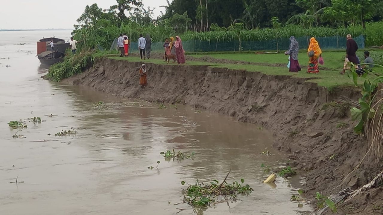



River erosion has intensified across various areas of Gaibandha following the continuous rise and fall of water levels, leaving thousands of residents in a state of panic. Homesteads and vast tracts of cultivable land are being swallowed by rivers at no fewer than 60 points across the district.
Affected residents have alleged that despite repeated assurances from the administration, no effective preventive measures are yet visible on the ground.
According to the latest data from the Bangladesh Water Development Board (BWDB) in Gaibandha, as of 2pm on Friday, the water level of the Teesta River at Kaunia point rose by 12cm, flowing 28cm below the danger level.
Meanwhile, the Brahmaputra River at Tistamukh point in Phulchhari decreased by 14cm, flowing 148cm below the danger level.

The Ghaghot River at the New Bridge point in the district town saw a 10cm decrease, flowing 186cm below the danger mark, while the Karatoya River at Chakrahimapur station in Gobindaganj rose by 140cm, remaining 190cm below the danger level. Notably, no rivers in the district have crossed the danger threshold during the current monsoon season.
On-site observations reveal large cracks appearing in homesteads, trees, bamboo groves, and croplands adjacent to the rivers. Many residents are desperately attempting to salvage their belongings, cutting down trees and dismantling houses to move them to safer locations.
The prolonged fluctuation of floodwater has already claimed numerous fertile plots in the char (river island) areas, with thousands of acres of farmland and several public and private structures now under threat.




Erosion has turned particularly severe at Dakshin Rasulpur in Phulchhari Upazila and at least 10 other points in the district. Locals in Dakshin Rasulpur reported that approximately 25 to 30 bighas of land have vanished into the river in the last 10 to 12 days. Saheb Uddin, a local farmer, lamented that while mostly farmland was lost initially, the river is now swallowing houses, orchards, and bamboo groves.
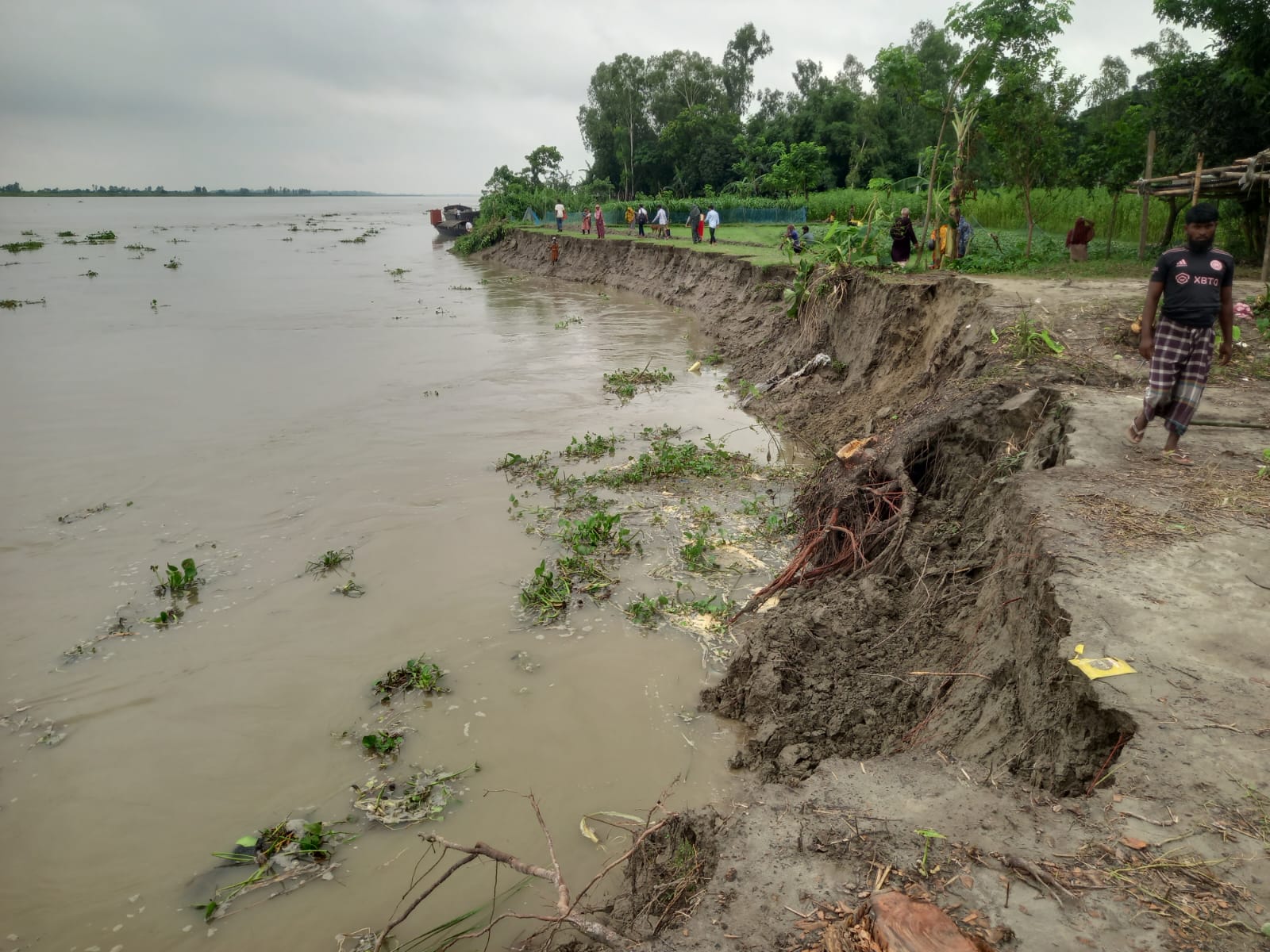
In Sundarganj Upazila, continued erosion in the Lal Chamar and Keranir Char areas of Kapsia Union has displaced over 200 families and destroyed more than 100 bighas of cropland. Other affected areas include Shakher Bazar in Kanchibari Union; Char Charitabari and Raghav in Haripur Union; Uttar Sicha in Chandipur Union; and Mintu Miar Char and Badamer Char.
Nuri Akhtar, a resident facing displacement, said the erosion became massive over the past week, leaving people unable to save anything. Farmer Chandu Miah described losing many of his large trees in a single morning.
“Everyone comes and gives assurances, but no one works,” he said. Rezia Bewa, who lost her 10-decimal plot and several trees, shared her uncertainty about where to seek shelter. Local residents have also blamed illegal sand extraction for the devastation. They alleged that sand was extracted using dredgers near Dakshin Rasulpur during the dry season, and those who tried to protest were met with death threats.
Despite visits from the deputy commissioner (DC) and the upazila nirbahi officer (UNO), locals claim no effective action, such as dumping geo-bags or blocks, has been taken.
Data suggests that at least 800 families across Gaibandha Sadar, Sundarganj, Phulchhari, Saghata, and Sadullapur upazilas have lost their homes recently due to the surge of water from upstream.
Atiqul Islam, deputy director of the Department of Agricultural Extension (DAE), said approximately 900 bighas of crops have been affected by the rising waters, including 30 hectares of jute, 45 hectares of Aush paddy, 25 hectares of sesame, 10 hectares of vegetables, and 8.02 hectares of Aman seedbeds, with the majority of the damage occurring in Sundarganj.
Md Shariful Islam, executive engineer of the Gaibandha BWDB, attributed the increased erosion to the long-term fluctuation of water levels. He said the board is currently attempting to prevent further damage by dumping geo-bags in the most vulnerable areas.