Heavy rain in India’s Sikkim hills and plains, combined with upstream runoff, has pushed the Teesta river above danger level, inundating large areas in northern Bangladesh and marooning thousands.
At 9am on Thursday (14 August), the river at Dalia Barrage in Lalmonirhat was flowing at 52.30 metres — 15 centimetres above the danger mark of 52.15 metres, according to the Water Development Board (WDB). The surge followed India opening all gates of the Gazaldoba Barrage upstream. To manage the flow, Bangladesh has opened all 44 gates of the Teesta Barrage at Dalia.
WDB Northern Region Superintending Engineer Ahsan Habib said water levels have risen sharply over the past 48 hours and may rise further in the next day. The Dharla and Dudhkumar rivers are also swelling. “We are giving priority to protecting educational institutions and government establishments at erosion points. Teams are working round the clock,” he said.
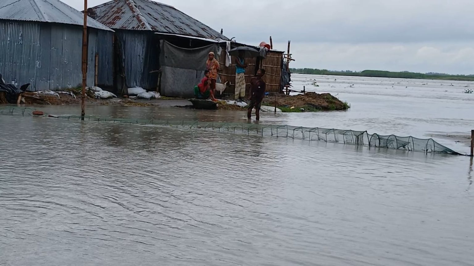
Continuous upstream rain and hill runoff have already flooded riverside lowlands, chars and islands in Dimla and Jaldhaka of Nilphamari; Hatibandha, Patgram, Kaliganj and Aditmari of Lalmonirhat; and parts of Rangpur, Kurigram and Gaibandha. WDB said 225 villages in five districts are under water, affecting about 200,000 people.
Many families in low-lying areas have moved to higher ground or taken shelter in flood-control camps, bringing livestock and essentials. Roads, bridges and rural infrastructure in char areas have collapsed, while over 100 ponds and fish farms have been washed away.
Floodwaters have submerged thousands of hectares of peanuts, jute and transplanted Aman paddy. Erosion has intensified, with WDB reporting 108 points of collapse across the Teesta and Dharla basins. Locals in Baishpukur mouza, Nilphamari, are reinforcing the Tuhin cross dam with bamboo, timber and sandbags to avert a breach that could flood four unions.
Rangpur Meteorological Office reported that in the past 24 hours, Panchagarh recorded 200mm of rain, Rangpur 21.4mm, Cooch Behar in West Bengal 10.5mm and Guwahati in Assam 80mm. The Met office forecast heavy to very heavy rainfall in the next 24 hours in Rajshahi, Rangpur, Sylhet and Mymensingh divisions, and upstream in West Bengal, Sikkim, Assam, Meghalaya and Arunachal Pradesh.
The WDB said the flood situation could worsen if the rainfall continues. Already, 152km along the Teesta basin and 360km in the Dharla-Brahmaputra areas have been affected. The Dharla and Brahmaputra rivers are also flowing high, putting more areas at risk.
Rangpur Divisional Commissioner Shahidul Islam said all deputy commissioners and upazila administrations have been instructed to move stranded residents to shelters quickly and provide food. “We are prepared to take people to safety and ensure emergency supplies,” he said.
Authorities warned that prolonged rain could lead to a major flood disaster across the Teesta basin. With water levels still rising and erosion points multiplying, officials fear the damage could expand in the coming days.