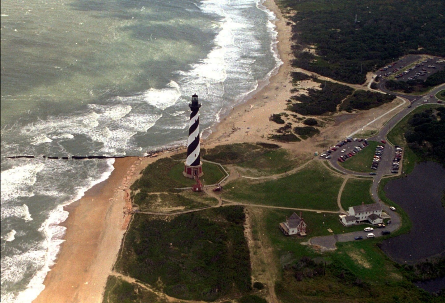
Hurricane Erin forced tourists to cut their vacations short on North Carolina’s Outer Banks even though the monster storm is expected to stay offshore after lashing part of the Caribbean with rain and wind on Monday.
Evacuations were ordered on some barrier islands along the Carolina coast as authorities warned the storm could churn up dangerous rip currents and swamp roads with waves of 15 feet (4.6 metres). Tropical storm and surge watches were issued Monday for much of the Outer Banks.
Officials at the Wrightsville Beach, near Wilmington, North Carolina, reported to the National Weather Service rescuing at least 60 swimmers from rip currents on Monday, reports AP.
Tourists and residents waited for hours in a line of cars at Ocracoke Island’s ferry dock — the only way to leave other than by plane.
National Hurricane Center hurricane specialist Dave Roberts said by Wednesday or Thursday Hurricane Erin could impact the Outer Banks.
Forecasters are confident Erin will curl north and away from the eastern US, but it is still expected to whip up wild waves and tropical force winds along the coastal islands, according to Roberts.
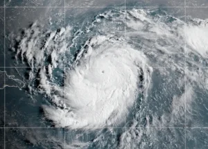
The storm intensified to a Category 4 with 140 mph (225 kph) maximum sustained winds Monday while pelting the Turks and Caicos Islands, and the southeast Bahamas, according to the center. By Monday night, sustained winds had dropped some to 125 mph (200 kph) with Erin about 690 miles (1,110 kilometres) southwest of Bermuda and about 780 miles (1,255 kilometres) southeast of Cape Hatteras.
Government officials in the Turks and Caicos Islands said all services were suspended on three of its islands and ordered residents there to stay home. Some ports also closed.
On North Carolina’s Outer Banks, coastal flooding was expected to begin Tuesday and continue through Thursday.
The evacuations that began Monday on Hatteras Island and Ocracoke came at the height of tourist season on the thin stretch of low-lying barrier islands that jut into the Atlantic Ocean and are increasingly vulnerable to storm surges.
A year ago, Hurricane Ernesto stayed hundreds of miles offshore yet still produced high surf and swells that caused coastal damage.
This time there are concerns that several days of heavy surf, high winds and waves could wash out parts of the main highway, the National Weather Service said. Some routes could be impassible for several days, authorities warned.
This is the first time Ocracoke has been evacuated since Hurricane Dorian struck in 2019, leaving behind the most damage in the island’s recorded history.
Scientists have linked the rapid intensification of hurricanes in the Atlantic to climate change. Global warming is causing the atmosphere to hold more water vapor and is spiking ocean temperatures, and warmer waters give hurricanes fuel to unleash more rain and strengthen more quickly.
Erin, the year’s first Atlantic hurricane, reached a dangerous Category 5 status Saturday with 160 mph (260 kph) winds before weakening. It is expected to remain a large hurricane into midweek.
Bermuda will experience the most severe threat Thursday evening, said Phil Rogers, director of the Bermuda Weather Service. By then, waters could swell up to 24 feet (7.3 metres).
Surfers, swimmers and boaters were urged to exercise caution as the dangerous water could pose a risk to their lives. Erin’s outer edges hit parts of Puerto Rico and the Virgin Islands with heavy rains and tropical storm winds Sunday, knocking out power to thousands.