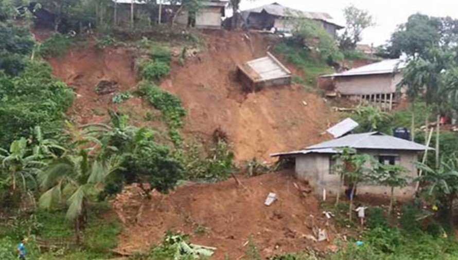
The Bangladesh Meteorological Department has warned of possible landslides in the hill districts of Bandarban, Rangamati, and Khagrachhari due to rainfall. In response, district administrations have urged residents living in vulnerable and hilly areas to evacuate and take shelter in safe zones and designated shelters.
Although intermittent rainfall has been reported in Bandarban, there has been no waterlogging so far due to swift drainage.
However, the risk of landslides remains.
According to the Flood Forecasting and Warning Centre of the Water Development Board, 55mm of rainfall was recorded in the Matamuhuri Basin (Lama) and 54 mm in the Sangu Basin (Bandarban) between 9am Sunday and 9am Monday. Despite the rain, both rivers are still flowing below the danger level.
Data from the Flood Forecasting and Warning Centre show that the danger level for the Sangu River at the Bandarban town point is 14.80 meters (MSL), while the water level was recorded at 10.57 meters at 3pm on Monday. Similarly, the danger level for the Matamuhuri River at the Lama point is 11.80 meters, but the recorded level at the same time was 9.78 meters.
Arup Chakraborty, executive engineer of the Water Development Board in Bandarban, said the threat of flooding or waterlogging in Bandarban and Lama towns may subside if the rainfall continues intermittently instead of becoming persistent.